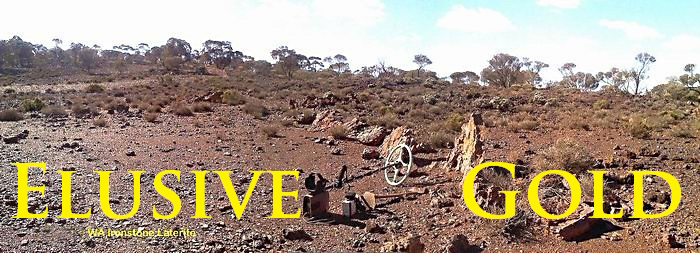
| |
My testimony - Paul Wohrman,
|
|
Back home after a busy
five weeks on the West Australian goldfields with host
Bill Denheld.
I went on a
wonderful trip to the place I always wanted to go. I
flew to Melbourne and was picked by my contact there
Bill Denheld. I had read an article in GPAA magazine
about this man taking prospectors to the Western
Australia, so I took him up on it.
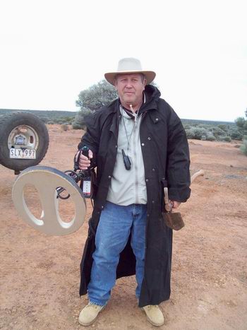
Tools of trade, MineLab GPX with
Coiltek Mono coil, GPS in pocket, walkie talkie
around my neck, handy pick, ready to go. This
was our everyday start.
I am standing on a lone hill in the middle of central West Australia.
The isolation and vastness of this country is
astonishing. However, great care is taken to be
safe around these parts, we're hundreds of miles
outback.
|
We drove all the way across Australia about 2000 miles, or 3000 km and stopped at various locations like the
Ballarat Gold Museum which had models of all the
famous largest solid gold nugget ever found in the
world, the 'Welcome Stranger', weighing 2520 troy oz of
gold. (78 KG)
Image -
http://www.ironicon.com.au/images/welcome-stranger.JPG
Another
large nugget, The 'Hand of Faith
with Bill pointing to it, that he is sure he detected in
an old diggers hole behind a school in country Victoria,
at a town named 'Kingower' during the 1980's. He tells
me he walked away from the signal due to heat exhaustion
after digging two previous deep holes there only to find
iron rubbish.
Image -
http://www.ironicon.com.au/images/hand-of-faith-nugget-was-missed-by-bill.jpg
A great deal of Australian gold is big, huge by any
standard.
Western Australia has some of the most beautiful scenery
and geology that I have ever seen.
Bill was an outstanding host, very hospitable and an all
round good 'bloke'. His knowledge on Geology is
outstanding, and we visited places where he has had luck
in the past as well as new remote ground. This fact
makes a trip like this all the more appealing. We used
Google Earth and last century historical gold maps and
records loaded into a real travel time Geology map
Tracker as we drove around that helped us pin point
potential search areas.
Bill had applied for all the necessary permits well
before I arrived, and spends a lot of time preparing for
his trips, and it was so much fun that I will be going
back next year, so if anyone wants to join me and meet
up with Bill just let me know. The best time is during
cooler winter months June, July. August with
temperatures ranging 60 to 80 degrees F. I would
recommend to anyone to think about it. The cost is no
more than if you joined a tourist package to some
'canned'
overseas country sight seeing. There is always the
chance you may
more than pay for your trip but with absolutely no
guarantees, but consider you have a ticket in the
lottery is how I see it.
Our trip. Bill had planned to spend the first
week in the Ora Banda area, except we learned from an
acquaintance, gold miners working there they had claimed
rights over most of the ground that Bill was interested
in, meaning, most of that territory would be out of
bounds although we had their permission to be there, but
we decided it would be too much of an intrusion. And as
well, the main road had been closed due to flooding. As
an alternative Bill had selected an out of the way
secluded area named Pykes Hollow on the shore of Lake
Carey between Leonora and Laverton WA some 300 km north
east.
To Pykes Hollow. As we approached the turn off
the weather was great and we seemed to have beaten a
southern ocean bad weather front that had spread over
most of southern parts of WA. Pykes Hollow was much
higher up, and as its name suggests this place is a
hollow in a huge sea of desert country that drains into
Lake Carey. Please click on the links below to see the
pictures.
Image from Google Earth of Lake Carey
http://www.ironicon.com.au/images/google-earth-lake-carey.jpg
We were about 100 km down a narrow barely used track
that swept around to our selected area where we made
camp.
Image
http://www.ironicon.com.au/images/camp-at-pykes-hollow.jpg
During mornings and nights some emus came by-
Image
http://www.ironicon.com.au/images/emu-pykes-hollow.jpg
I managed to find myself a huge target at the
Hollow for which I needed Bills help. The ground was
hard. My detected target was excellent unlike some
earlier ones and seemed too good to be true. I started
to dig it for while but it got too much and we took
turns. As a joke Bill advised the deal had changed and
if he helped me dig I would have to share some of it,
but it was always ' I keep what I find' even if it was a
100 oz nugget, and this was sure to be the big one.
Image
http://www.ironicon.com.au/images/IMGP3527.JPG
To record and
savour the moment Bill went and got the car close and he
kept taking pictures of my great find.
Wide image
http://www.ironicon.com.au/images/IMGP3530-pauls-find.jpg
We had to dig and chop through some very hard ground and
'natural cement' to 18 inches deep to get it out-http://www.ironicon.com.au/images/IMGP3536.JPG
The moral of this story is to never give up, but how in
the heck could a 'coke can' get six feet along a rabbit
warren. Right from the start Bill had a bad feeling
about a big target signal amidst a rabbit warren. l was
as deflated as a burst balloon.
Finally a huge storm front reached us up north and all
across the middle of WA and the weather started to
change.
Anyway, we ventured and detected from our camp until a
constant drizzle of light rain became our concern. After
the forth day we began to think we may not get out of
this. We would pack up immediately and make a run for it
but not before we took a 27 km test drive to test the
track without the camper in case we got stuck as it
would be impossible to turn the car and camper around,
and all seemed ok. We quickly packed up and went for it.
By this time the constant rain had softened the track to
the point where some strong forward momentum assured
passing through some very boggy diversionary track
parts. All was well till we came to the main track out.
We had became aware on our drive in that some had
already gotten stuck, and during our camping there we
had seen some four wheel drive vehicles and a large
mobile home bus heading out to the main road that ran
between Leonora and Laverton.
Our decision to get out proved correct as the 100 km
journey out was slow but it was not till the last
several hundred yards that we nearly floundered. This,
our only exit road had been bogged down by the constant
rain and this had turned the track into the worst bog
imaginable. When we hit the quagmire with the Merc
engine revving hard in second gear with the pedal on the
floor, it almost stalled, but some how we got through.
A fortnight
later we stopped by this section and took this picture.
Image-
http://www.ironicon.com.au/images/last-bog-out.jpg
Ora Banda. We took refuge by heading back down
south to now accessible Ora Banda, where a hotel and a
near empty caravan park, we were able to wash up with
hot showers and a powered site. The Ora-Banda area has
produced a lot of gold in the past. We met up with the
park owner's son in law whose friends had invited us to
a gun shoot in an old gold pit nearby. I own several
guns myself as did Bill. so we had a lot of fun with
these fellows. Incidentally, the Ora Banda hotel is
famous for a fire bombing several years ago when it was
owned by a corrupt Perth city Police Detective who had
set up the Mickleburg brothers for the alleged 'Great
Perth Mint Swindle' back in the 1980's. Apparently a
bikie gang took exception to the corrupt detective and
had him blown up in Perth after the failed fire bombing
of the Ora Banda hotel, Image- Ora Banda Hotel - (now
repaired).
http://www.ironicon.com.au/images/ora-banda-hotel.jpg
Heading on to Laverton and Burtville area.
A friend of Bill's, Mick Delany had told him he knew the
manager of Laverton Downs Station - Mr. Keith Dudley,
and we should pop in. Laverton Downs Stn was about 300
miles north and on arrival we were welcomed. The Downs
is approximately 70 thousand acres , (or 28 thousand hectares)
that sports some - but merge gold mining areas. The word
was - a little gold had been found although of little
consequence around these particular parts. The homestead
had in early days been used for the first council
meetings for district of Laverton, so named after Dr
Laver whose interest in gold mining established the
town. Hence Laver-ton.
Image -
http://www.ironicon.com.au/images/laverton-downs-stn-wa2.jpg
We met Stn manager Keith after a long days drive and he
accommodated us the first night in his managers house
spare bedrooms which was great. This meant we did not
need to put up the camper and tent after dark. In the
morning Keith woke us early and invited us to an early
morning walk, which we did. One striking feature of the
Downs is the fantastic looking geology for gold. Another
was the Sandal Wood shrubs that are prolific here and
once supported a vast industry in WA as a major
exportable commodity. Sandal wood oil being very
fragrant had been used in incense for many centuries.
Image, Keith and me at a Sandalwood bush. The wood is
now protected by cutters quotas. -
http://www.ironicon.com.au/images/keith-and-paul-3538.jpg
After taking long drives north, south east and west from
our base camp at the Downs we soon realised many areas
of gold country had been well done over during the past
thirty years by detector operators. One other
detectorist and assistant Downs manager accompanied us
on our searches. His name is Tony Sharp and is author of
several children's books.
Tony gave us a guided tour of the Down's few old gold
worked areas and was keen to learn more himself about
the geology, and he too had the latest MineLab GPX 5000
detector. Image,
http://www.ironicon.com.au/images/tony-sharp-1257.jpg
Laverton Downs Stn while relatively close to other
important gold discoveries in the district is a pastoral
lease and currently to be 'drilled' by exploration
mining companies. However, having permission from Downs
manager Keith, to explore the country, word was 'very
little gold' had been found here. To Bill there was no
reason why gold could not be found anywhere here?
Bill felt the clue was to find an area of heavy black
water worn ironstone gravels with quartz lying on a flat
gentle slope where the bedrock sometimes pokes through
to the surface, it had to be water worn pepper and salt
gravels, and this had eluded us thus far. My stay had
come to an end and I was to fly out in two days, and
Bill had decided to start packing the camper as he would
take me to the Kalgoorlie airport for my flight back
home to New York.
The pack up day had started slow, and Bill suggested I
go with Tony detecting. Tony had suggested to take his
motor bike for a whiz around the bush looking for that
black gravel Bill had told us about and Tony had said he
remembered a likely area several miles away. Tony took
Bills HemaHN6 GPS with geo maps loaded on his bike so we
could later identify the area in Geo terms. Within 20
minutes Tony was back reporting he had found a likely
area with water worn black gravels. Bill said he would
continue packing up but suggested Tony take me so we
could detect the place. Within an hour un expectedly we
had big smiles on our faces - I had found gold exactly
as predicted.
http://www.ironicon.com.au/images/pauls-patch-first-gold.jpg
What to do? We went back to the downs and got
Bill. He instantly dropped the packing and we spent the
rest of the day detecting the area. All of us got gold
that day. The saddest thing though was I was to be
leaving the very next day.
The area was named Paul's Patch now proves gold can be
found where no gold has been found before.
Image -
http://www.ironicon.com.au/images/pauls-patch_1237.jpg
The following day Bill drove me to Kalgoorlie for
my flight out. During this time Tony was able to detect
the area more thoroughly. However, after my return home
in the USA, Bill continues the story.
The day after Paul had flown out from Kalgoorlie, Tony Sharp had spent the
day exploring the vast area looking for similar ground
detecting as he went. We are talking about thousands
of Acres. It became apparent that Paul's Patch was a
lucky find. So Bill and Tony decided to grid the place
by dragging a chain attached to their belts, thus marking
the ground as they went to be sure all gold along our
tracks would found. Bill informed me he let Tony
decide the area he would chain. Image-
http://www.ironicon.com.au/images/pauls-patch-tony1239.jpg
Bill kept out of Tony's way because detectors too close
together interfere with each other. After a while Bill
had decided to go over to where he had previously found
a little nugget on that yellow looking dirt some
distance away from my 'Paul's Patch'. It was here that
Bill found numerous other gold nuggets as marked by the
xx's.
Image
http://www.ironicon.com.au/images/pauls-patch-bills-spot.jpg
The significance of this yellow ground was 'all' the
pepper and salt had been eroded away over thousands of
years leaving only the heavier gold in crevices on
the bedrock. Here then is some of the gold. Image of
gold-
http://www.ironicon.com.au/images/pauls-patxh-3539.JPG
To all those who
think you need to be a rocket scientist, well it helps a
little but utterly non essential.
Thanks to all those who made this trip possible.
Paul Wohrman.
|
|